Scenic USA - Virginia
Each day Scenic USA presents a different and interesting photo feature from somewhere in
the United States. Chosen from a wide variety of historic sites, city scenes, back-country
byways, points of interest and America's best parklands, this site offers the viewer hundreds
of unique vacation destinations and photographic subjects. Each feature is coupled with a
brief explanation. For further detailed information, links to other sites are provided, however
these links should not be considered an endorsement.

Other nearby
Points of Interest
At no extra cost to you, using this link helps support Scenic USA when you shop on-line at Amazon
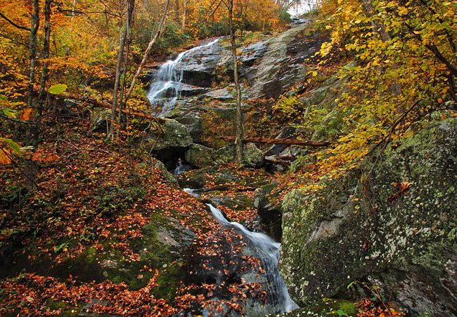
Crabtree Falls
| Photos by Ben Prepelka |
Covering sections of Kentucky, West Virginia and Virginia, the Jefferson and Washington national forests combine to form one of the largest assemblies of public land in eastern United States.  Made up of 1.8 million acres, over half of this forestland remains remote and undeveloped. With conservation in mind, it's unfortunate that only 140,000 acres have been deemed wilderness area, taming any future development. Each fall this forestland becomes a favorite destination for scenic drives and nature hikes.
Just east of I-81 and the town of Vesuvious, Route 56 travels through the George Washington National Forest. This winding scenic highway eventually leads to the Crabtree Falls Observation Site and a series of five waterfalls. Named for 18 century settler William Crabtree, this beautiful cascade is among Virginia’s most picturesque waterfalls. Said to be the tallest waterfall in the east, Crabtree Falls is credited with a 1200 foot vertical drop.
A paved pathway leads to the lower falls and is easily accessible from the parking lot. 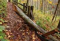 The trail climbs upward to the remaining cascades on the right side of Crabtree Creek, where the mile long footpath offers plenty of waterfall viewpoints.
Ambitious hikers may continue beyond the waterfalls to mountaintop overlooks and follow Crabtree Creek to Crabtree Meadows and the upper parking lot. Group hikers have an advantage of staging a vehicle for the return trip back down the mountain.
Although the trail is well maintained by the U.S. Forest Service, visitors are warned that the rocks here are covered with a very slippery plant growth, and everyone is advised to stay on designated pathways. Twenty-eight people have fallen to their deaths from attempts to climb too close to the falls, with the most recent death occurring in April, 2013.
Area Map
Copyright © 2013-15 Benjamin Prepelka
All Rights Reserved