Scenic USA - Utah
Each day Scenic USA presents a different and interesting photo feature from somewhere in
the United States. Chosen from a wide variety of historic sites, city scenes, back-country
byways, points of interest and America's best parklands, this site offers the viewer hundreds
of unique vacation destinations and photographic subjects. Each feature is coupled with a
brief explanation. For further detailed information, links to other sites are provided, however
these links should not be considered an endorsement.

Other nearby
Points of Interest
Fossil Butte National Monument
At no extra cost to you, using this link helps support Scenic USA when you shop on-line at Amazon
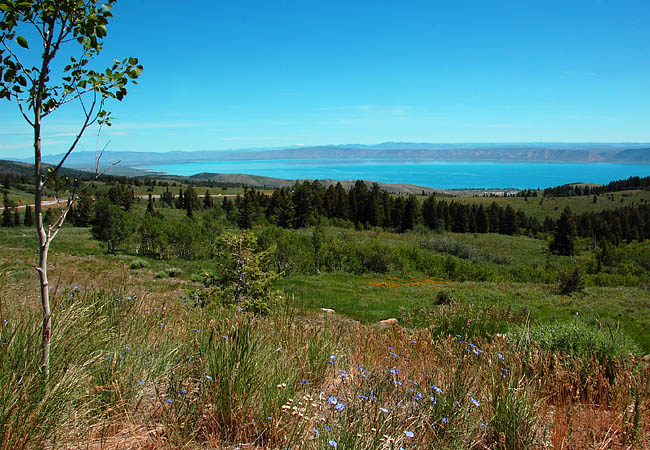
Bear Lake
| Photos by Ben Prepelka |
A 19th century gathering place to  exchange goods and supplies for furs, mountain men, such as Jedediah Smith and Jim Bridger, would rendezvous with American Indians at southern end of Bear Lake. Although thousands of pioneers passed near the lake during the early to mid 1800s, it wouldn't be until 1863 before Mormon settlers started to live along the lakeshore.
Fast-forward to the 20th century, it's easy to imagine the lake's beautiful aqua blue waters would attract developers. Sometimes called the Caribbean of the Rockies, the Bear Lake area would be divided into building lots around the shoreline and up into the foothills. Wrestled from developers, the State of Utah purchased a southeastern beach area  for a state park and also operates a marina on the western shore. Used as a reservoir and for agricultural irrigation, the lake doubles as a summer recreational retreat. Straddling the border of Utah and Idaho, the lake's enchanting blue waters and sand beaches draw in anglers, boaters and campers. But by winter, the area is snow covered and the lake remains frozen well into spring.
Where U.S. Route 89 follows the western shoreline, the Oregon Trail-Bear Lake Scenic Byway picks up at the Idaho border. This two lane section of Route 89 continues through small farming communities as views of the lake slowly disappear. The 110 mile byway then heads west on Route 30 to Soda Springs, Bancroft and Lava Hot Springs, ending near I-15.
Area Map
Copyright © 2013-15 Benjamin Prepelka
All Rights Reserved