Scenic USA - Wyoming
Each day Scenic USA presents a different and interesting photo feature from somewhere in
the United States. Chosen from a wide variety of historic sites, city scenes, backcountry
byways, points of interest and America's best parklands, this site offers the viewer hundreds
of unique vacation destinations and photographic subjects. Each feature is coupled with a
brief explanation. For further detailed information, links to other sites are provided, however
these links should not be considered an endorsement.

Byway Points
of Interest
Clarks Fork Trail Cooke City MT/WY
Crazy Creek & Lake Creek Falls WY
Rock Creek Vista Point Rest Area MT
Red Lodge Mountain Ski Area MT
At no extra cost to you, using this link helps support Scenic USA when you shop on-line at Amazon
Beartooth Mountain Byway
| Photo by Mark Nielsen The Beartooth (photo inset) by Wm. S. Keller |
The Beartooth All-American Highway, following U.S. Route 212, has been proclaimed one of the most scenic drives in the United States. This corridor passes through three national forests, the North Absaroka Wilderness, near 1000 glacial lakes, showcases a series of majestic mountain peaks, and highlights the highway's namesake, a huge granite fang called the Beartooth. This rugged, high altitude byway boasts 20 peaks over 12,000 feet, a large population of wildlife and photographic opportunities in every direction.
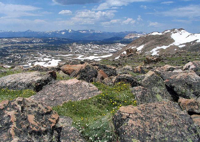
Charles Kuralt described the scenic highway as the most beautiful drive in America. In 1989, it achieved national attention with an official designation as a National Scenic Byway. The 68 mile route begins at Red Lodge, Montana, climbs multiple switchbacks as it gains nearly 3000 feet in 12 miles, then it crosses the Wyoming border to Beartooth Pass. Topping out at the pass, nearly 11,000 feet, the byway gradually descends westward into Cooke City, Montana, before heading to the northeast entrance of Yellowstone National Park. The highway, opening in 1936, remains an amazing feat of engineering and commands top billing as a must see item during any Yellowstone visit. This chilly scenic view takes in the Beartooth Pass area and is a visual reminder that this alpine route passes through some of the most extreme terrain in the world, staying open for only four to five months a year.
Byway Map
Copyright © 2007-14 Benjamin Prepelka
All Rights Reserved