|
Scenic USA - Arizona Kachina Leaf Lane |
|

| Photos by Dr. Rob Jones Rob's Humphreys Peak Trip Report |
Often visible from Flagstaff, the San Francisco Mountains rise more than a mile above the surrounding grasslands and forests of northern Arizona. Part of the southern Colorado Plateau and topped off with the tallest peak in the state, this mountain area is believed to be the remains of a large strato-volcano. The tree covered basin is actually a huge caldera formed during a series of eruptions beginning about one million years ago.
The Kachina Peaks Wilderness area is associated with a mountain complex biome, ranging from desert species at the lowest elevations, up through aspen and conifer forests to an alpine tundra zone above the tree line.
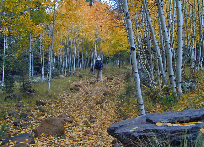
Just a sort distance from Flagstaff, hikers find the Kachina Peaks Wilderness dotted with trails throughout its 74,000 acres. This inviting scene found along Weatherford Trail, gives a strong hint that this section of wilderness land is covered with a dense aspen grove. The Weatherford Trail follows an old auto road (mechanical vehicles are restricted) and intersects with Humphreys Peak Trail. Ambitious hikers may take this route to the highest peak in Arizona. Views from the top on Humphreys Peak take in the City of Flagstaff, Oak Creek Canyon and beyond to Verde Valley.
Area Map
|
Additional Area Attractions |
|
Copyright © 2007-16 Benjamin Prepelka
All Rights Reserved