Scenic USA - Montana
Scenic USA offers a collection of select photographs from a wide variety of attractions, points of interest, historic sites, state and
national parks found throughout the United States. Each photo feature is coupled with a brief explanation.
For further detailed information, links to other related sites are provided.
Kootenai River
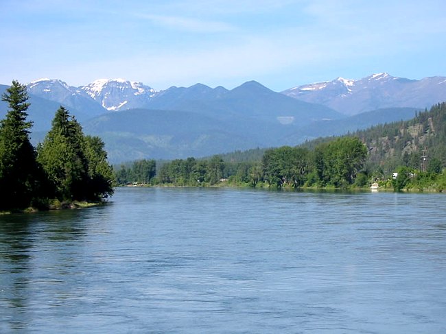
| Photo provided by BigSkyFishing.com |
|
At one time this wild river, swollen with early summer snow melt and rain, ran free and ripped through northern Montana from north of the Canadian border and Kootenay National Park. The Kootenai River's strong currents and unyielding waters created numerous broad river valleys and deep gorges. Today, the river is held in check by Montana's Libby Dam, creating Lake Koocanusa that backs up into British Columbia. The river, named for the nearby Kootenai people (Kitunahan), still experiences fluctuations in water flow, but often allows for a leisurely |
 rafting, canoeing or kayaking
Copyright ©2008 Benjamin Prepelka
All Rights Reserved