Scenic USA - Oklahoma
Each day Scenic USA presents a new and interesting photo feature from somewhere in the United States. Chosen from a wide variety
of historic sites, city scenes, backcountry byways, points of interest and America's best parklands, this site offers the viewer hundreds
of unique vacation destinations and photographic subjects. Each feature is coupled with a brief explanation. For further detailed
information, links to other sites are provided, but are never to be considered an endorsement.
Talimena Scenic Byway
|
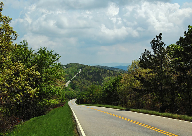
The Talimena Scenic Byway, straddling the Arkansas-Oklahoma border, skips across some of the highest mountain tops between the eastern Appalachians and the western Rockies. This 38 mile route winds through the Ouachita National Forest, showcasing its grand vistas, rugged landscape and a primitive forest abundant with wildlife.
Beginning in the town of Mena, Arkansas, the byway follows Route 88 passed the Rich Mountain Fire Tower, Queen Wilhelmina State Park and the Pioneer Cemetery Historic Site. Here at the eastern end, just two miles from Mena, mountain bikers may take on the Earthquake Ridge Trails. With tracks ranging from novice to expert, these biking trails offer a marvelous setting to enjoy the great outdoors.
At the border, byway travelers will see the State Line Historic Site. Brought in with mules, the five foot historic marker once indicated the border between the state of Arkansas and the Choctaw Nation.
Now in Oklahoma, the byway offers a string of overlooks where panoramic views of the Winding Stair and Rich mountains reveal more of nature's splendor. Byway travelers may stretch their legs at the Kerr Arboretum and Nature Center. Three short interpretive trails highlight different aspects of the forest life-cycle. Westward, the byway approaches the Winding Stair National Recreation Area, captured in the byway photo. In the mountaintop campground, overnighters experience an austere wilderness setting, powered only by the sun.
One of the last stops before reaching U.S. Route 271, the breathtaking Panorama Vista presents 270 degree views of Blue Mountain, Lake Wister, Holson Valley, Tombstone Mountain and the Potato Hills.
Southward, Route 271 leads to the Talimena State Park and the town of Talihina. If you're ready for lunch after a morning on the byway, the park offers picnic sites and pavilions. In town you'll find a dozen diners and restaurants.
Byway Map
|
Copyright © 2012 Benjamin Prepelka
All Rights Reserved
