Scenic USA - South Carolina
Each day Scenic USA presents a different and interesting photo feature from somewhere in
the United States of America. Chosen from a wide variety of historic sites, city scenes, back-
country
byways, points of interest and America's popular parklands, this site offers the viewer
hundreds of unique vacation destinations and photographic subjects. Each photo is coupled
with a brief explanation. For further detailed information, web links to other sites are provided,
however these links should not be considered any type of endorsement.

Other nearby
Points of Interest
Mountain Bridge Wilderness Area
Jocassee Gorges Management Area
Poinsett Bridge Heritage Preserve
At no extra cost to you, using this link helps support Scenic USA when you shop on-line at Amazon
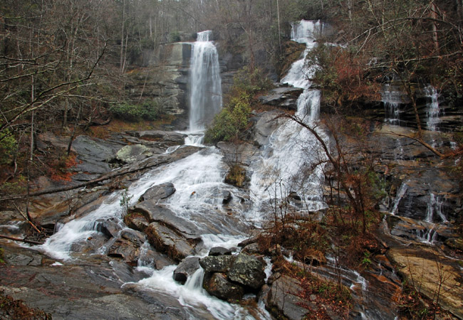
Twin Falls (Reedy Cove Falls)
| Photos by Ben Prepelka |
Tucked into the northwest corner of the state, South Carolina's Upcountry is a land dominated by Blue Ridge Mountain foothills, miles of forestland acreage and a variety of scenic wonders. A land well suited for recreation, the area boasts many sparkling lakes and mountain streams, numerous state parks, heritage preserves, large wilderness areas and over 100 waterfalls.
Here along the border with North Carolina, waterfall fans are treated to some of the most beautiful  waterfall settings in the South. Ranging in height from 40 to 700 feet, area waterfalls are found in parks, roadside attractions and some that are hidden away in rugged wilderness lands. This vast collection of waterfalls may create the perfect family outing or an extended backcountry adventure. Similar to Wildcat Branch and Issaquena falls, Twin Falls is within a short walk from a parking area. Here in the Jocassee Gorges Area, Reedy Cove Creek splits upstream, sending two 70 foot
 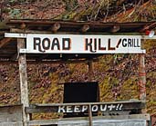 cascades down a bare granite cliff face. Also called Eastatoe Falls and Reedy Cove Falls, these twins are just a short drive from Route 178 and the city of Pickens. Bob's Place and the Road Kill Grill, perched on a hillside between Moorefield Memorial Highway (Route 178) and Cleo Chapman Highway, are distinct landmarks for the turnoff to the falls. Continue to Eastatoe Community Road (right) and on to Waterfall Road. An old roadbed leads out to the falls boardwalk and viewing platform. This early spring photo catches the falls area without a typical layer of dense foliage and a full flowing Reedy Cove Creek.
Area Map
Copyright © 2013-15 Benjamin Prepelka
All Rights Reserved