Scenic USA - Ohio
Each day Scenic USA presents a different and interesting photo feature from somewhere in
the United States. Chosen from a wide variety of historic sites, city scenes, back-country
byways, points of interest and America's best parklands, this site offers the viewer hundreds
of unique vacation destinations and photographic subjects. Each feature is coupled with a
brief explanation. For further detailed information, links to other sites are provided, however
these links should not be considered an endorsement.

Other nearby
Points of Interest
Hopewell Culture National Monument
Hocking Valley Scenic Railroad
At no extra cost to you, using this link helps support Scenic USA when you shop on-line at Amazon
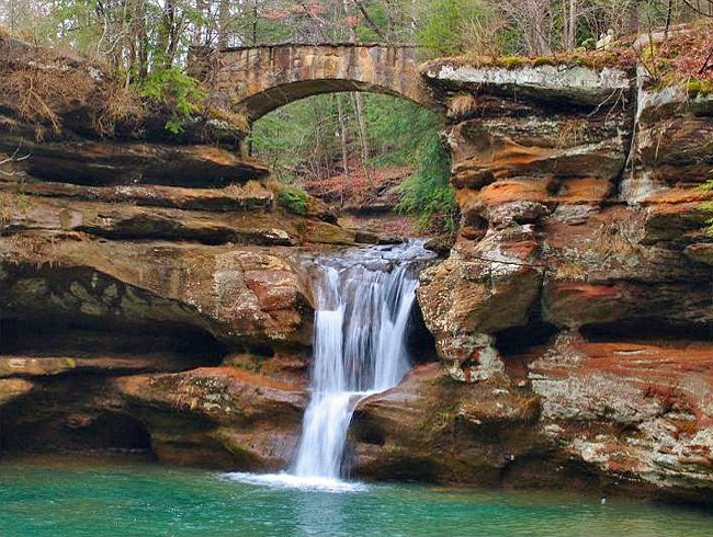
Upper Falls-Old Man's Cave
| Photos by Gregory Hamilton Gregory Hamilton Photography |
Probably a favorite among the half  dozen sections of Hocking Hills State Park, Old Man's Cave is tucked into a half mile gorge, chisled away by Old Man's Creek. Just like its northern neighbor at Blackhand Gorge State Nature Preserve, the runoff from melting glaciers carved numerous gorges through the Hocking Hills Black Hand Sandstone. The ancient Black Hand Formation, a conglomerate, makes up some of Ohio's most splendid scenery. Here in the Hocking County region, the scenic sandstone cliffs are found throughout the park sections of Old Man's Cave, Rock House, Ash Cave, Cantwell Cliff, Conkle's Hollow and Cedar Falls.
This beautiful view captures the Upper Falls and one of the old stone bridges that crosses the creek just above Old Man's Cave. The old man, Richard Rowe, lived on the property, enjoying this beautiful setting every day during his stay in the 1800s. Today it's hard to imagine having this gorge all to yourself as thousands of visitors trek through the park every year. A stone stairway and tunnel were carved 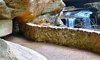 and sculpted into the Blackhand Sandstone, creating cozy niches and enticing pathways leading to all three tiers of waterfalls.
Here at the Upper Falls a six mile trail connects Old Man's Cave with Cedar Falls and Ash Cave, part of Ohio's Buckeye Trail. From the Lower Falls area, a two mile blue blazed trail continues on to Queer Creek and Cedar Falls, one of the more remote sections of the state park.
Area Map
Copyright © 2009-14 Benjamin Prepelka
All Rights Reserved