Scenic USA - Colorado
Each day Scenic USA presents a different and interesting photo feature from somewhere in
the United States. Chosen from a wide variety of historic sites, city scenes, back-country
byways, points of interest and America's best parklands, this site offers the viewer hundreds
of unique vacation destinations and photographic subjects. Each feature is coupled with a
brief explanation. For further detailed information, links to other sites are provided, however
these links should not be considered an endorsement.

Other nearby
Points of Interest
At no extra cost to you, using this link helps support Scenic USA when you shop on-line at Amazon
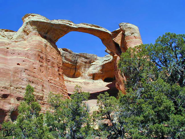
Akiti Arch
| Photos by Dr. Rob Jones Rob's Rattlesnake Canyon Trip Report |
In October 2000, Congress established the 75,550 acre Black Ridge Canyons Wilderness, forming the core of Colorado Canyons National Conservation Area. Although the site is within three miles of I-70, access to the Black Ridge Canyons Wilderness and Rattlesnake Canyon remains fairly challenging. The shortest route to Rattlesnake Canyon is over a winding five mile hiking trail from the Pollack Bench Trailhead (Horsethief Canyon State Wildlife Area). Depending on the season, Black Ridge access road leads into Mee Canyon from the adjacent Colorado National Monument. It's then a rugged road to the Rattlesnake Canyon arches trailhead.
Why go through all this bother?
Well, here in Rattlesnake Canyon you'll find the second largest concentration of natural rock arches in the United States, 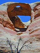 over 75,000 acres of solitude, fantastic cliffs and pinnacles, and incredible canyonland scenery.
Pictured here is Akiti Arch, looming high overhead with a span of 40 feet and a 120 foot high opening. This is one of the many majestic arches found along a three mile trail. Bear in mind that this a rather remote area and although climbing through these arches appears as a natural thing to do, the BLM advises staying on the designated trail. Motorized access on the Black Ridge access roads are closed yearly from February 15th through April 15th. Visitors are cautioned not drive on either road when wet. The Rattlesnake Arches vicinity is day-use only with camping available along the access roads into the area. At the present time, no permits are required for day use of the Black Ridge Canyons Wilderness. Permits for camping and use of the Colorado River (forming the northern boundary of the wilderness) are required.
Area Map
Directions
Permit Information
Copyright © 2009-14 Benjamin Prepelka
All Rights Reserved