|
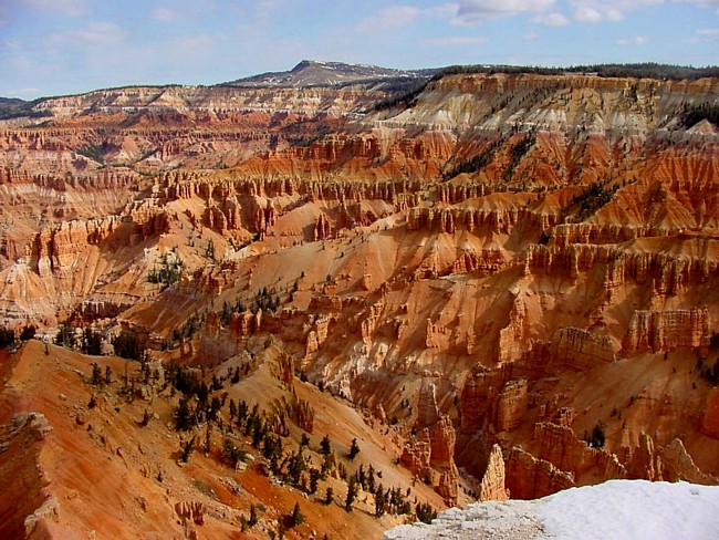
Not quite a canyon, and shaped like a huge amphitheater, Cedar Breaks appears as a little sister to its eastern neighbor, Bryce Canyon. Its brightly colored rock layers, dropping down from the rim nearly 2,000 feet, contain an intriguing mix of spires, pinnacles, arches, and a collection of small ravines. A palette of earth tones, ranging from yellows, reds, oranges and purples, stain the countless sandstone layers.
Because of its high elevation, park temperatures remain cool in the summer. Snow comes early and often lingers into late spring. Its skies are some of the darkest in the continental United States. And what better way to celebrate Cedar Breaks National Monument’s 75th anniversary than to invite guests to a star party. Other festivities during the event included a history tour, famous lunches from the Cedar Breaks Lodge, and a campfire sing-along. Its seems that the star party, led by the Las Vegas Astronomical Society, was a most impressive introduction to the universe for the guests that braved the cool night air.
It’s no surprise that the unusual name, Cedar Breaks, comes from a misunderstanding. Native American called the area circle of painted cliffs, but early settlers focused on the Utah juniper, mistaking them for cedar trees. Badland were called breaks, and the name Cedar Breaks lived on. The park is noted for its photogenic cliffs, hiking and camping opportunities. Most of the park trails are easy, but because of the park’s 10,000 foot altitude, some visitors may encounter a challenge. The main trail follows along the canyon rim from the visitor center. A two mile hike leads to Spectra Point and Ramparts Overlook. Rattlesnake Creek-Ashdown Gorge Trail leads to the adjacent Ashdown Gorge Wilderness, a section of remote preserve that some hope will one day be added to Cedar Breaks.
|